Overview
PAVICS is a Spatial Data Infrastructure (SDI) for climate data. It is composed of modular components that together provide access to data and a library of climate services. It is meant to facilitate climate data analysis for both researchers and climate service providers. PAVICS is not intended to be installed on individual computers, but rather on servers located close to data archives.
There are multiple building blocks composing the PAVICS SDI:
- Birdhouse
Web Processing Services (WPS) supporting data processing in the climate science community. It includes multiple sub-components:
- Birdhouse/Finch
A library of climate indicators.
- Raven
A WPS server for the extraction of watershed properties.
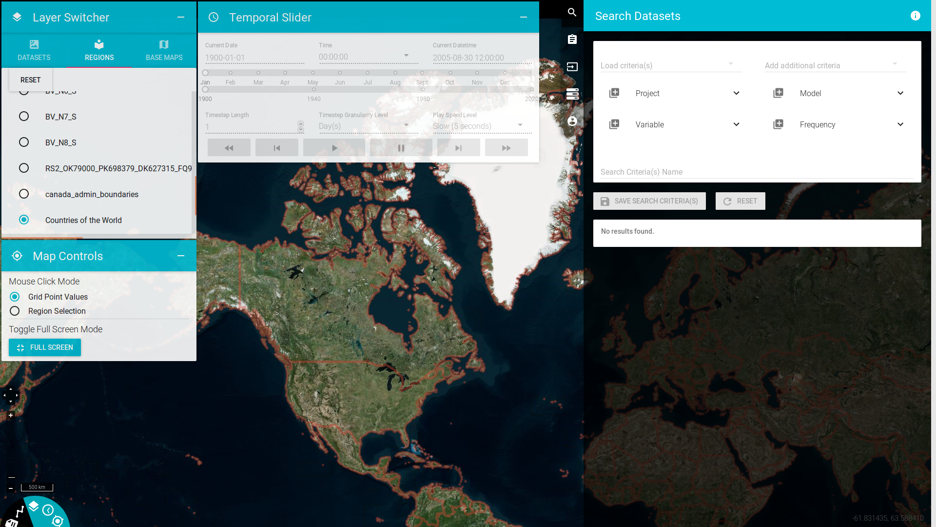
- JupyterLab
A notebook interface to demonstrate how WPS services can be used from a programming environment.
- Magpie
Authentication and authorization services.
- Weaver
Workflow Execution Management Service (EMS) and Application, Deployment and Execution Service (ADES) supporting legacy WPS services as well as OGC API - Processes REST bindings.
- THREDDS
NetCDF data server.
- GeoServer
Geospatial data server.
These components work together to offer users a seamless access to data and a suite of services that can convert raw climate data into useful information, graphics and tables.
Credits
PAVICS is led by Ouranos, a regional climatology research consortium, and CRIM, an informatics and software research institute, (both located in Montreal, Quebec, Canada) to provide climate scientists with a set of tools to acquire and analyze climate data. The project was initially funded by the CANARIE research software program, and has since benefited from contributions from the Open Geospatial Consortium, the Québec Ministry of Environment and Fight Against Climate Change, Environment and Climate Change Canada and the Canadian Foundation for Innovation.